Cadastral Maps Built From the Record
GeoDrafts provides cadastral mapping services from the deeds, recorded plats, and coordinate records you supply — parcel linework, lot and block structures, and land records graphics drafted to your office standards.
Legend — Monuments
Each layer is a survey type — click one to open its page.
What This Service Covers
We draft parcel linework from supplied legal descriptions and recorded plats, organize lot, block, and subdivision structures, annotate dimensions and record references as directed, and assemble cadastral map sheets on your templates. Every drawing follows the written instructions and source records your office provides — interpretation and boundary determination remain with your licensed professionals.
GeoDrafts provides drafting production only. Records research direction, boundary determination, and certification remain with the licensed professionals responsible for the project.

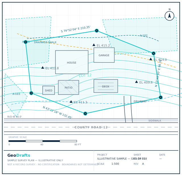

Cadastral Mapping Services, Layer by Layer
This service's layer is highlighted on the plan. Click other layers to explore the related survey types we draft.
Legend — Monuments
Survey Type · Boundary
Boundary and Property Survey Drafting
Preparation of boundary and property survey drawing deliverables based on client-provided survey information, records, measurements, and applicable drafting instructions.
Click any layer on the plan — each one maps to a survey type we draft.
Typical Inputs
What we work from — all supplied by you.
- Deeds, legal descriptions, and recorded plats
- Coordinate lists and control information
- Existing cadastral drawings or GIS parcel layers
- Record references, document numbers, and source notes
- Client map templates and cadastral drafting standards
Deliverables & Formats
What you receive at handover.
- Parcel fabric and cadastral base drawings
- Lot, block, and subdivision annotation
- Record reference tables and source notes
- Map sheets with PDF plots for review
Where This Work Fits
Land records modernization projects
Parcel fabric maintenance drafting
Assessor and mapping department support
Subdivision and annexation record graphics
How the Project Runs
Review records
Supplied deeds, plats, and references are checked for completeness.
Build the framework
Parcel structure and control are organized before drafting.
Draft parcels
Linework and annotation are drawn from the supplied records.
Verify against record
Geometry and references are checked against the source documents.
Deliver files
Organized CAD and plot files are handed over in your structure.
Cadastral Mapping Services — Questions
Continue Exploring
Ready to Start Cadastral Mapping Services?
Share your project inputs and receive a scoped proposal.
Request a Quote