Corridor Sheets That Stay Consistent, Mile After Mile
GeoDrafts provides road and highway survey CAD drafting from your supplied alignment geometry and corridor data — stationing, plan and profile sheets, cross-section sets, and existing-features mapping produced to your sheet standards.
Legend — Monuments
Each layer is a survey type — click one to open its page.
What This Service Covers
We draft centerline alignments and stationing from supplied geometry, assemble plan-and-profile sheets, plot cross-sections from supplied section data, and map existing corridor features — pavement edges, structures, drainage, and utilities — on your templates with consistent sheet series production.
GeoDrafts provides drafting production only. Engineering design and survey certification remain with the licensed professionals responsible for the project.
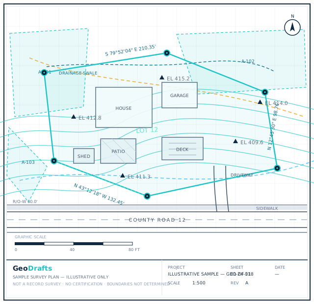

Road and Highway Survey Drafting, Layer by Layer
This service's layer is highlighted on the plan. Click other layers to explore the related survey types we draft.
Legend — Monuments
Survey Type · Road & ROW
Route and Right-of-Way Survey Drafting
Alignment drawings, strip maps, and right-of-way exhibits for roads, pipelines, and corridors, prepared from supplied stationing and parcel data.
Click any layer on the plan — each one maps to a survey type we draft.
Typical Inputs
What we work from — all supplied by you.
- Alignment geometry and stationing information
- Profile and cross-section data from your survey
- Corridor topographic and utility information
- Design direction and instructed annotation
- Sheet series templates and plan-production standards
Deliverables & Formats
What you receive at handover.
- Alignment and stationing plan sheets
- Plan-and-profile sheet series
- Cross-section drawing sets
- Corridor existing-conditions base mapping
Where This Work Fits
Highway and municipal road documentation support
Corridor as-built and record drawings
Right-of-way and alignment exhibits
Construction plan production support
How the Project Runs
Review corridor data
Alignment, section, and topo data are checked for completeness.
Set up the series
Sheet templates, matchlines, and stationing are established.
Draft the sheets
Plan, profile, and section sheets are produced to scope.
Check consistency
Stationing, annotation, and sheet-to-sheet continuity are verified.
Deliver the set
The organized sheet series is handed over for professional review.
Road and Highway Survey Drafting — Questions
Continue Exploring
Ready to Start Road and Highway Survey Drafting?
Share your project inputs and receive a scoped proposal.
Request a Quote