Point Clouds In, Drafted Plans Out
GeoDrafts converts supplied point cloud and LiDAR data into clean CAD deliverables — planimetric linework, building sections and elevations, and contour drawings traced from the datasets your crews capture.
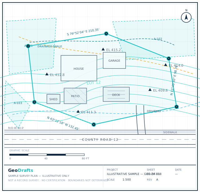
Legend — Monuments
Each layer is a survey type — click one to open its page.
What This Service Covers
We extract planimetric features as directed from supplied LAS/LAZ/E57 datasets, draft building elevations and sections from laser scans, generate contour linework from point data, and organize every output on your layers — working from decimated exports or agreed tiling for large datasets.
GeoDrafts provides conversion drafting only. Registration, control, and survey certification remain with the licensed professionals responsible for the dataset.

Point Cloud to CAD Conversion, Layer by Layer
This service's layer is highlighted on the plan. Click other layers to explore the related survey types we draft.
Legend — Monuments
Survey Type · Spot Levels
FEMA Elevation Certificate Drafting
Supporting diagrams and drafted documentation for elevation certificates, prepared from your field data for review by the licensed surveyor.
Click any layer on the plan — each one maps to a survey type we draft.
Typical Inputs
What we work from — all supplied by you.
- Point cloud files (LAS, LAZ, E57, or decimated exports)
- Intensity imagery and scan positions where available
- Feature lists defining what to trace
- Drafting instructions and level-of-detail direction
- Client templates and layer standards
Deliverables & Formats
What you receive at handover.
- Planimetric CAD drawings traced from the cloud
- Building sections and elevation drawings
- Contour and terrain linework
- Layer-organized files with PDF review plots
Where This Work Fits
Scan-to-CAD existing conditions documentation
Mobile mapping and LiDAR corridor extraction
As-built and heritage documentation support
Drone LiDAR data processing for survey deliverables
How the Project Runs
Review the dataset
Coverage, density, and coordinate information are confirmed.
Agree the feature list
What gets traced — and to what detail — is fixed in writing.
Trace and draft
Features are extracted and drafted to your standards.
Verify coverage
Drafted work is checked against the cloud for completeness.
Deliver files
Organized CAD files are handed over with processing notes.
Point Cloud to CAD Conversion — Questions
Continue Exploring
Ready to Start Point Cloud to CAD Conversion?
Share your project inputs and receive a scoped proposal.
Request a Quote