Every Survey Type.One Drafting Partner.
Twenty-two production services spanning boundary and title work, topographic and site surveys, construction and utility projects, and geospatial data — all drafted to your standards, reviewed before handover.
Precision Technology. Reliable Drafting Support.
Scalable CAD drafting and GIS production for surveying, engineering, and mapping teams — delivered on your templates, to your standards, and checked before every handover.
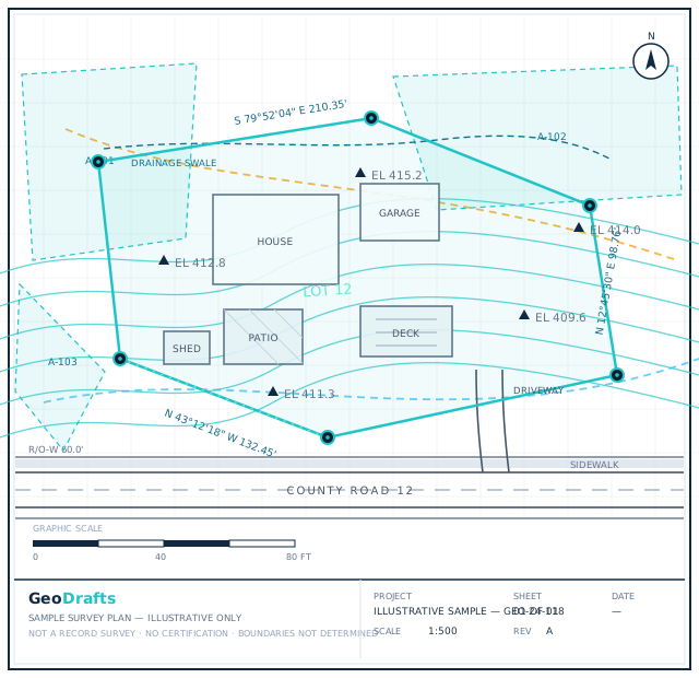
Pick a layer on the plan — the matching survey type appears on the right.
Legend — Monuments
Survey Type · Boundary
Boundary and Property Survey Drafting
Preparation of boundary and property survey drawing deliverables based on client-provided survey information, records, measurements, and applicable drafting instructions.
Click any layer on the plan — each one maps to a survey type we draft.
All Combined Types of Surveys We Cover
Twenty-two survey drafting and GIS production services, grouped by discipline. Each has its own detailed page with scope, inputs, deliverables, and FAQs.
Boundary, Title & Land Records
Topographic, Site & Existing Conditions
Construction, Utility & Linear Projects
Data, Drone & GIS Production
From Field Data to Final Drawing
The same disciplined path on every project — your raw inputs in, a checked drawing out.
Field Data In
Points, sketches, field books, and records shared exactly as your crew collected them.
Data Organized
Coordinates checked, layers assigned, and records filed against the project.
Drafted to Standard
Linework, symbols, and annotation built on your template and drafting standards.
Checked Twice
Reviewed against your written instructions and our internal project checklist.
Final Drawing Out
Delivered in your formats — organized, named, and ready for issue.
Running Fully In-House vs With GeoDrafts Support
Outsourced drafting production doesn't replace your team — it removes the bottleneck around it.
Fully In-House Production
- Drafting queues pile up during peak season
- Licensed staff get pulled into production linework
- Every workload spike triggers a hiring cycle
- Overflow work waits for internal capacity
With GeoDrafts Support
- Production capacity flexes with your workload
- Your licensed professionals stay on fieldwork and review
- No recruitment overhead for temporary peaks
- Extra volume moves in parallel, on your standards
AutoCAD Civil 3D · Carlson Survey · MicroStation · ArcGIS · QGIS · LandXML · Google Earth Pro
DWG · DXF · DGN · SHP · GPKG · GeoJSON · KML/KMZ · LAS/LAZ · CSV · PDF
Questions Surveyors Ask Us
The practical questions we hear from licensed surveyors and firm owners — answered plainly.
Have Field Data Waiting for a Drawing?
Send the data you have — points, sketches, or full field packages. We'll confirm scope and get production moving.