Elevation Certificate Support, Prepared for Review
GeoDrafts prepares supporting diagrams and drafted documentation for elevation certificates from the field data you supply — organized for review and certification by the authorized professional.
Legend — Monuments
Each layer is a survey type — click one to open its page.
What This Service Covers
We draft building diagrams from supplied measurements, organize elevation documentation per your direction, and format supporting drawings so the certifying professional can review and complete the certificate efficiently.
GeoDrafts provides drafting support only. Elevation certificates are completed, reviewed, and signed exclusively by authorized licensed professionals.

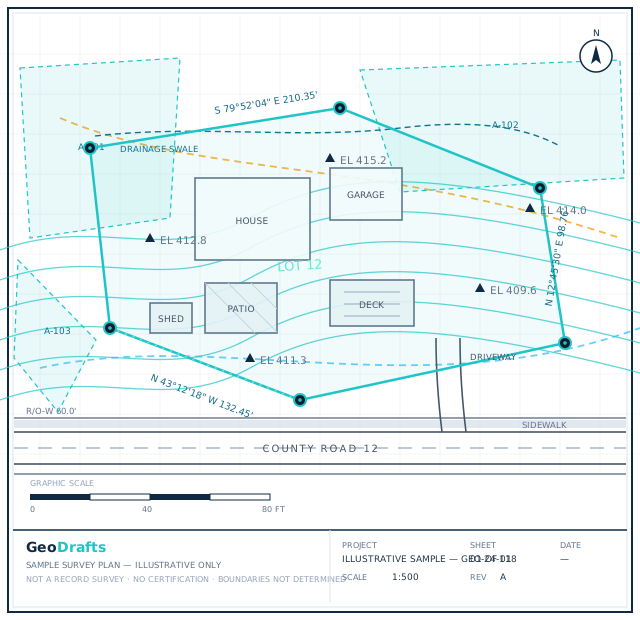

FEMA Elevation Certificate Drafting, Layer by Layer
This service's layer is highlighted on the plan. Click other layers to explore the related survey types we draft.
Legend — Monuments
Survey Type · Spot Levels
FEMA Elevation Certificate Drafting
Supporting diagrams and drafted documentation for elevation certificates, prepared from your field data for review by the licensed surveyor.
Click any layer on the plan — each one maps to a survey type we draft.
Typical Inputs
What we work from — all supplied by you.
- Field elevations and building measurements supplied by the client
- Photographs and observation records, where provided
- Client certificate format and documentation standards
- Written instructions on required diagrams
Deliverables & Formats
What you receive at handover.
- Drafted building diagrams
- Measurement and elevation annotation as instructed
- Supporting drawing sets in agreed formats
Where This Work Fits
Floodplain documentation support packages
Insurance-related drawing sets prepared by the surveyor
Consistent certificate support production
Archiving organized documentation
How the Project Runs
Review field data
Supplied elevations and measurements are organized.
Draft diagrams
Building diagrams are drawn from the supplied data.
Annotate
Measurements and notes are added per your direction.
Check
Documentation is reviewed against the source data.
Deliver
Files are handed over for professional review.
FEMA Elevation Certificate Drafting — Questions
Continue Exploring
Ready to Start FEMA Elevation Certificate Drafting?
Share your project inputs and receive a scoped proposal.
Request a Quote